Al Khail Road, Dubai: A Vital Lifeline Connecting the City’s Past, Present, and Future
In the fast-paced evolution of Dubai, few roads capture the city’s growth story quite like Al Khail Road (E 44). Once a utilitarian highway, it’s now a vital transportation artery that not only links major districts within Dubai but also extends toward the mountain town of Hatta, providing a scenic, high-speed alternative to Sheikh Zayed Road and Emirates Road.
This powerful infrastructure corridor, designated as E 44, traverses a complex mix of urban centers and outer developments. It has evolved under multiple names—Al Khail Road, Ras Al Khor Road, Al Aweer Road, and eventually the Dubai-Hatta Highway—each reflecting the diverse regions it serves.
What Makes Al Khail Road So Important?
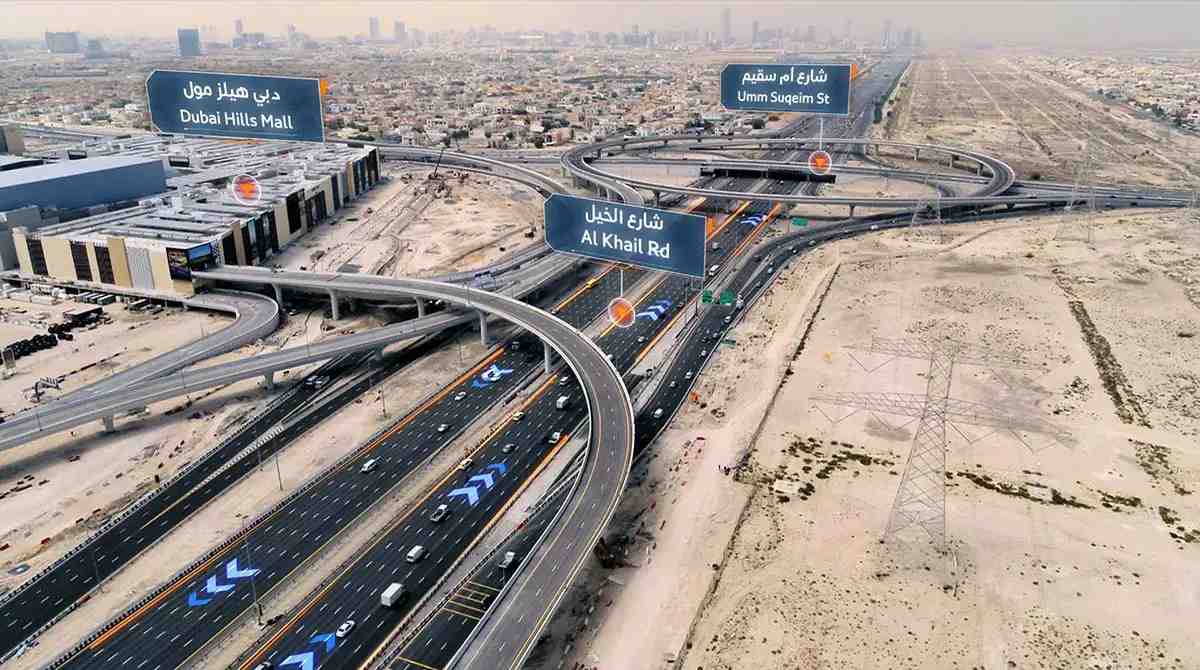
Al Khail Road spans over 15 kilometers, with 12 major interchanges, slicing through key zones like Al Quoz, Business Bay, Meydan, Jumeirah Village Circle, and Zabeel. As Dubai continues its transformation into a future-ready smart city, Al Khail Road plays a pivotal role in supporting the movement of people, goods, and innovation.
In February 2024, the Dubai Roads and Transport Authority (RTA) committed AED 700 million toward the road’s next transformation phase. This ongoing upgrade involves:
- Over 3,300 meters of new bridges,
- 6,820 meters of roadway enhancements,
- Critical upgrades at seven strategic nodes, including Ghadeer Al Tair and the entrance to Al Meydan.
This isn’t just road work; it’s infrastructure modernization aligned with Dubai’s 2040 Urban Master Plan.
Al Khail Road’s Multi-Named Journey
One of Al Khail Road’s fascinating features is its polymorphic identity. As E 44:
- Between E 311 and D 68, it’s known as Al Khail Road.
- From D 68 to E 311, it becomes Ras Al Khor Road.
- The segment between E 311 and E 77 is called Al Aweer Road.
- Beyond, it stretches into the Dubai-Hatta Highway, passing through Al Madam and Masfout before reaching the Hatta Border Crossing.
This continuity of purpose despite name changes reflects how infrastructure in Dubai is engineered for both local accessibility and long-haul connectivity.
Designed for Flow: The Infrastructure Behind the Drive
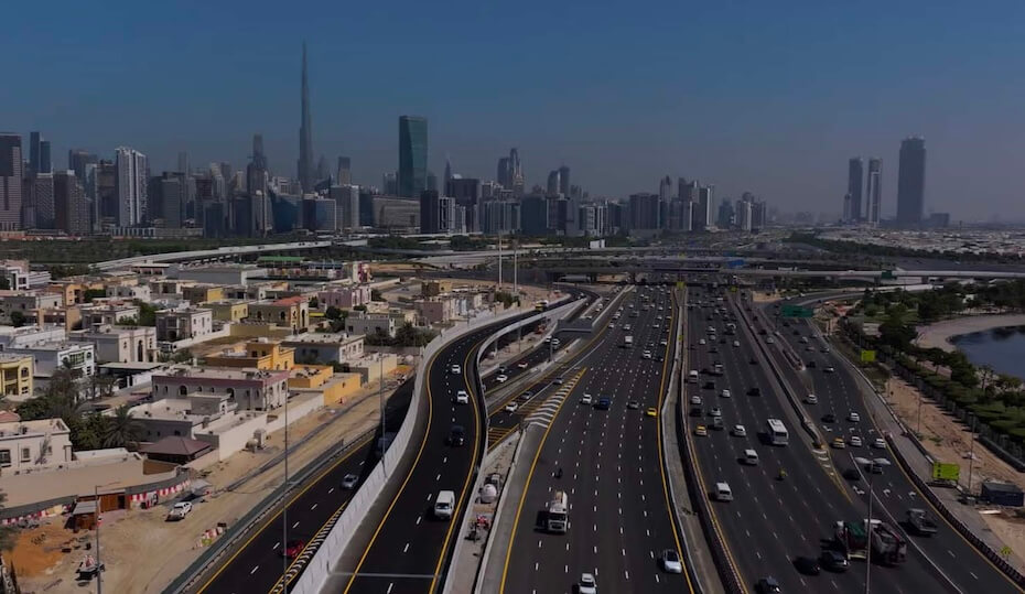
Al Khail Road is no longer a traditional highway—it’s a multilane, high-capacity express route engineered to meet future traffic demands. The road expansion project, led by AECOM and overseen by RTA, brought a series of smart upgrades:
- Roundabouts replaced with flyover interchanges to reduce stop-start friction,
- Lane expansions from four to six in each direction,
- Full utility infrastructure upgrades along the extended stretch.
With this, the route ensures free-flowing traffic, particularly during peak hours—a key advantage for commuters traveling between Dubai and Abu Dhabi or accessing Dubai’s growing outer districts.
Al Khail Road and Dubai’s Urban DNA
Al Khail Road has always been more than asphalt and concrete. It mirrors Dubai’s push toward decentralization—connecting emerging hubs like Dubai Hills Estate, Nad Al Sheba, and Dubai Silicon Oasis to core business districts. It supports residential communities, facilitates logistics traffic, and provides alternatives during peak congestion on Sheikh Zayed Road.
Thanks to its link to Hatta, a rugged exclave known for eco-tourism and adventure sports, Al Khail Road also boosts domestic tourism, giving city dwellers direct access to mountain trails, dams, and heritage villages.
Travel Smart: Why Al Khail Road is a Game-Changer
Whether you’re a daily commuter, logistics provider, or leisure traveler, Al Khail Road offers:
- Quicker east-west movement across Dubai,
- Lower congestion compared to older highways,
- Access to fast-growing residential zones,
- Integration with major roads and future transit networks.
For anyone navigating Dubai, Al Khail Road isn’t just an option—it’s a smart route optimized for the city’s rapid pace.
Trust TheDubaiWeb.com for Local Navigation Insights
At TheDubaiWeb.com, we bring you up-to-date information on Dubai’s evolving infrastructure, lifestyle, and urban development. Whether you’re moving across the city or planning your next real estate investment, our trusted insights help you navigate smarter. If you’re relocating, commuting, or doing business in areas along Al Khail Road, explore our transportation services and local guides tailored for residents and expats alike.
FAQs about Al Khail Road, Dubai
Q: What is Al Khail Road also known as?
Al Khail Road is part of the E 44 highway. It also appears as Ras Al Khor Road, Al Aweer Road, and Dubai-Hatta Highway, depending on the segment.
Q: How long is Al Khail Road?
It spans approximately 15 kilometers within Dubai and continues toward Hatta, serving as a major arterial route.
Q: What are the recent upgrades to Al Khail Road?
In 2024, the RTA initiated a major upgrade with AED 700 million in contracts covering bridge construction, lane expansions, and road enhancements across key intersections.
Q: Which areas does Al Khail Road connect?
It connects Dubai’s business zones like Business Bay and Zabeel to residential communities such as Jumeirah Village Circle and Dubai Hills, and stretches toward Hatta.
Q: How is Al Khail Road different from Sheikh Zayed Road?
While both are major highways, Al Khail Road runs parallel and serves as a less congested alternative, especially useful for intercity travel and access to emerging districts.

- Gymnastics Training Programs in Dubai - February 26, 2026
- Mina Rashid Screening Center, Dubai Guide, UAE - February 23, 2026
- Al Sabkha Deira Dubai Area Guide, UAE - February 21, 2026