Dubai Metro Green Line, UAE: The Ultimate Guide to Dubai’s Historic Transport Corridor
The Dubai Metro Green Line is far more than a public transportation route — it’s a lifeline through the heart of old Dubai, linking the city’s heritage with its modern ambitions. Stretching 22.5 kilometers from Etisalat (now known as e&) in Al Qusais to Creek Station near Al Jaddaf Marine, the Green Line seamlessly connects key commercial zones, bustling souks, residential neighborhoods, healthcare hubs, and cultural landmarks. For both residents and visitors, this line is a critical gateway to experiencing the authentic essence of Dubai.
A Glimpse into the Green Line: Route and Technical Highlights
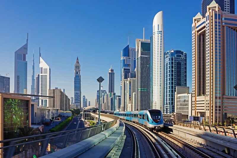
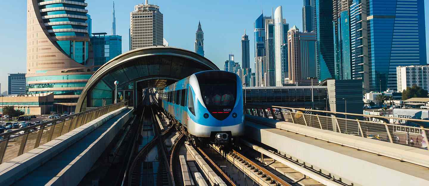
Commissioned in September 2011 and extended in 2014, the Green Line comprises 20 stations, including 12 elevated and 8 underground stops. This fully automated, driverless transit system was built by a renowned consortium including Mitsubishi, Obayashi, Kajima, and Yapı Merkezi.
Here are the core statistics that define the Green Line:
- Length: 22.5 km (14 miles)
- Stations: 20 total
- Underground Segment: 7.9 km
- Train Speed: Up to 110 km/h (68 mph)
- Train Capacity: Each train can carry 643 passengers
- Frequency: Trains arrive every 6 to 9 minutes
- Depots: Main depot at Al Qusais
The Green Line runs parallel to Dubai Creek, weaving through two of the city’s oldest districts: Deira and Bur Dubai. These neighborhoods are rich in history, commerce, and culture — offering travelers a rare look at traditional Dubai life through the convenience of modern infrastructure.
Station-by-Station: Landmarks and Transfer Points
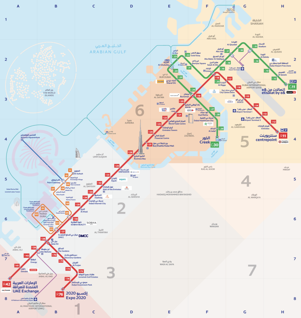
Every station on the Green Line offers access to key areas of interest. Here’s a breakdown of the stops and their nearby landmarks:
Key Green Line Stations and Highlights:
- G11 – e& (Etisalat): Ample parking, ideal for commuters
- G13 – Dubai Airport Free Zone: Close to logistics hubs and Dubai International Airport
- G16 – Al Qiyadah: Largest elevated station; near Dubai Police HQ
- G20 – Union: Major interchange with Red Line; one of the world’s largest metro stations
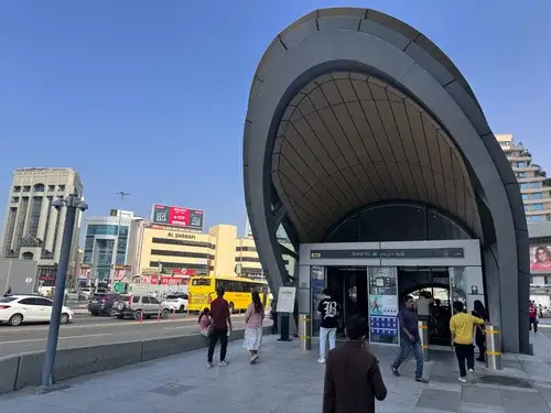
- G22 – Gold Souq: Gateway to Dubai’s traditional gold market in Deira
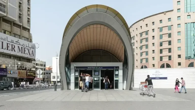
- G24 – Al Ghubaiba: Links to water ferries and abra stations
- G26 – BurJuman: High-traffic transfer hub with direct access to Red Line
- G30 – Creek: Terminal station near Al Jaddaf Marine and ferry to Dubai Festival City
Recommended: Dubai Metro Red Line
Interchange Stations:
- Union Station: A 25,000 sqm engineering marvel with a capacity of 22,000 passengers/hour
- BurJuman Station: A critical transit node between old and new Dubai
For a full station map and journey planner, TheDubaiWeb.com offers a comprehensive Dubai Metro Guide.
Fares, Zones, and Nol Cards: How Much Does It Cost?
The Dubai Metro uses a zone-based fare system, and the Green Line traverses Zones 5 and 6.
Fare Breakdown:
- 1 Zone: AED 4
- 2 Adjacent Zones: AED 6
- More than 2 Zones: AED 8.5
- Day Pass (Regular): AED 20
- Day Pass (Gold Class): AED 40
We highly recommend getting a Nol Card — a rechargeable smart card valid across the metro, trams, buses, and select taxis. For frequent travelers, activating a day pass on the Nol card is both economical and convenient.
Note: Nol Cards are not valid for the Palm Monorail.
Timings: When Does the Green Line Operate?
Dubai Metro operates seven days a week with extended timings on weekends:
| Day | Operating Hours |
|---|---|
| Sunday | 05:50 to 00:00 |
| Monday | 05:50 to 00:00 |
| Tuesday | 05:50 to 00:00 |
| Wednesday | 05:50 to 00:00 |
| Thursday | 05:50 to 01:00 |
| Friday | 10:00 to 01:00 |
| Saturday | 05:50 to 00:00 |
Trains arrive every 6 to 9 minutes, ensuring minimal wait time even during peak hours.
The Creek Extension and What Lies Ahead
Originally planned to span 17.6 km, the Green Line was extended to 22.5 km with the opening of Al Jadaf and Creek stations in 2014. The Creek Station’s strategic location near Al Jaddaf Marine Station connects commuters to boat services, including abras that link to Dubai Festival City Mall.
Future plans include a proposed extension to Academic City, aiming to better serve the Silicon Oasis, International City, and education zones — enhancing connectivity for students and professionals alike.
Why Choose the Green Line?
Whether you’re exploring Deira’s gold markets, commuting to healthcare hubs, or connecting to ferries at Dubai Creek, the Green Line offers a highly efficient, clean, and cost-effective transit solution. With bi-lingual signage (Arabic and English), intuitive wayfinding, and climate-controlled stations, it’s engineered for ease and comfort.
Looking for more ways to get around Dubai smartly? Check out TheDubaiWeb.com’s updated guides on:
Frequently Asked Questions
What are the main stations on the Dubai Metro Green Line?
Notable stops include e& (Etisalat), Dubai Airport Free Zone, Al Qiyadah, Union, Gold Souq, Al Ghubaiba, BurJuman, and Creek.
How long is the Dubai Metro Green Line?
The line spans 22.5 kilometers (14 miles), with 20 stations in total.
What are the timings for the Green Line?
Operational daily, with extended hours on Thursdays and Fridays. Trains run every 6–9 minutes.
Is Al Ghubaiba on the Green Line?
Yes. Al Ghubaiba is on the Green Line and also connects to Dubai’s water transport network.
Can I transfer to the Red Line?
Yes, at Union and BurJuman stations.
How do I pay for rides on the Green Line?
Use a Nol Card to tap in and out. Fares depend on zones crossed, with day passes available.
For more on Dubai’s world-class transport system, cultural attractions, and smart travel tips, stay tuned to TheDubaiWeb.com — your trusted companion for life in Dubai.