Ras Al Khor Road, Dubai: The Complete 2026 Area & Route Guide
Ras Al Khor Road is one of those Dubai names everyone has heard and almost no one can precisely place. Some people know it as the road that takes them past the flamingos. Others know it as the stretch you drive through to reach the auto workshops and spare-parts market. And plenty of residents simply know it as “that road near Downtown that always seems to have three different names.”
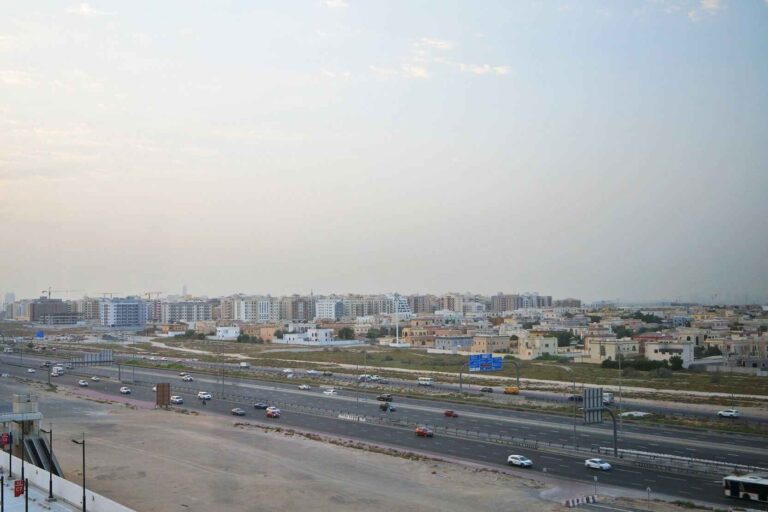
All three impressions are correct – and that’s exactly why this guide exists. Ras Al Khor Road is a specific, official segment of Dubai’s E44 highway, running between the Al Khail interchange and Sheikh Mohammed Bin Zayed Road. Along that stretch, it borders the Ras Al Khor Wildlife Sanctuary on one side and the Ras Al Khor Industrial Area on the other, before feeding into a growing residential pocket. Very few resources online explain the road, the sanctuary, the industrial zone, and the residential community together, with the level of route-level accuracy drivers, residents, and visitors actually need.
This guide covers all of it: where Ras Al Khor Road physically runs, how it fits into the wider E44 corridor, how to reach the wildlife sanctuary correctly (including the timing confusion that trips up most visitors), what the industrial area offers, what it’s like to live nearby, and what’s changing in 2026.
What Is Ras Al Khor Road, Exactly?
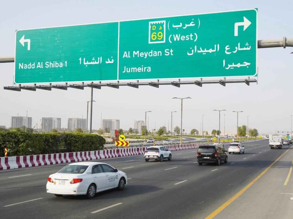
Ras Al Khor Road is the official name given to a defined segment of the E44 highway, one of Dubai’s core arterial routes. According to Dubai’s route-numbering system (maintained by the Roads and Transport Authority, RTA), E44 changes names four times as it crosses the emirate, and Ras Al Khor Road is only one part of that journey.
The E44 corridor, in order, running roughly southwest to northeast:
| Segment Name | Approximate Boundaries | Character |
|---|---|---|
| Al Khail Road | Jumeirah Village Triangle / E311 to D68 | Urban, multi-lane, connects Business Bay, Al Quoz, JVC, Dubai Hills |
| Ras Al Khor Road | D68 to E311 (Sheikh Mohammed Bin Zayed Road) | Borders the wildlife sanctuary and industrial area |
| Al Aweer Road | E311 to E77 | Eastern outskirts, logistics-heavy |
| Dubai–Hatta Highway | E77 onward | Long-distance route to Hatta and the Oman border |
This means when someone says “Ras Al Khor Road,” they are technically referring to a roughly 6–8 kilometre stretch, not the entire E44 route. Locals and even some property listings use “Ras Al Khor Road,” “Al Khail Road,” and “Al Aweer Road” interchangeably – which is understandable given they’re the same physical carriageway, but it’s worth knowing the precise boundary if you’re navigating, addressing mail, or researching a specific building.
Key takeaway: Ras Al Khor Road = the E44 segment between D68 and E311. It’s flanked by Dubai Creek and the wildlife sanctuary to the west, and the industrial and residential zones to the east.
Where is Ras Al Khor Road located
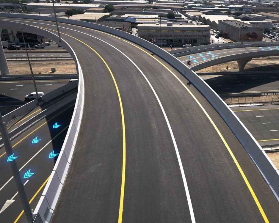
Ras Al Khor Road sits in the eastern part of Dubai, tracing the edge of Dubai Creek at the point where the creek widens into mudflats and lagoons – which is also why “Ras Al Khor” translates from Arabic as “Cape of the Creek” or “Head of the Creek.” The road effectively separates two very different landscapes: open wetland to the west, and dense industrial-commercial development to the east.
Because it sits at this junction point, Ras Al Khor Road connects some of Dubai’s most important districts without requiring drivers to enter the city centre:
- Downtown Dubai and Business Bay – roughly 10–15 minutes via Al Khail Road
- Dubai International Airport (DXB) – around 15–20 minutes via Nad Al Hamar Road
- Dubai Festival City – about 12 minutes
- Sheikh Mohammed Bin Zayed Road (E311) – direct interchange, opening up access to Sharjah, Al Warqa, and Mirdif
- Dubai Design District (d3) and Dubai Creek Harbour – a short drive across the creek
This connectivity is the main reason Ras Al Khor Road matters beyond its immediate neighbourhood: it functions as a bypass corridor that lets traffic move between old Dubai (Deira, Bur Dubai) and new Dubai (Downtown, Business Bay, Dubai Hills) without merging onto the more congested Sheikh Zayed Road.
Driving on Ras Al Khor Road: Junctions, Traffic, and Tolls
Ras Al Khor Road is a multi-lane, high-capacity carriageway, typically posted at 100–120 km/h depending on the stretch, and forms part of the wider E44/Al Khail Road corridor that the RTA has been progressively upgrading – including flyover interchanges replacing older roundabouts and additional lanes added in each direction to manage growing traffic volumes.
Three practical points matter most for drivers:
Salik toll gates. As of the most recent public data, the E44 corridor (Al Khail Road / Ras Al Khor Road) has no dedicated Salik toll gate directly on this stretch, unlike Sheikh Zayed Road, which carries three. This makes Ras Al Khor Road a genuinely toll-free alternative for east–west journeys, and one reason logistics and industrial traffic favours it.
Traffic patterns. Because the road serves the Ras Al Khor Industrial Area, expect heavier truck and commercial-vehicle traffic during standard business hours (roughly 8 AM–6 PM), and lighter congestion on weekends. Residents inside the community report the surrounding highways carry more noise and traffic pressure than the interior streets, which are comparatively quiet.
Key interchanges. The main access points along Ras Al Khor Road connect to Nad Al Hamar Road (airport access), Oud Metha Road (toward the wildlife sanctuary’s main hide access), and the E311 interchange (Sheikh Mohammed Bin Zayed Road), which is the primary link toward Sharjah and Dubai’s eastern suburbs.
Ras Al Khor Wildlife Sanctuary: The Definitive Visitor Guide
The Ras Al Khor Wildlife Sanctuary is the single most searched-for landmark associated with this road, and it deserves a properly sourced, accurate explanation – because timing information across the web is genuinely inconsistent, and getting it wrong means a wasted trip.
What the sanctuary is
Established in 1985 and formally declared a protected area on 1 March 1998, the sanctuary is managed by Dubai Municipality and sits at the point where Dubai Creek meets Ras Al Khor Road. It was recognised as a Ramsar Wetland of International Importance in 2015, placing it among a global network of ecologically significant wetlands. The reserve spans mudflats, lagoons, mangroves, and salt flats covering roughly 6.2 square kilometres, and functions as a critical stopover on the East African–West Asian migratory flyway – meaning birds travelling between Africa and Central Asia rely on it as a resting point during migration.
The sanctuary supports several hundred recorded species across its ecosystem, with the Greater Flamingo as the standout attraction, alongside herons, egrets, ospreys, spoonbills, and numerous wader species.
Visiting hours – why sources disagree
You’ll find at least three different sets of opening hours quoted online for the sanctuary. Rather than pick one arbitrarily, here’s what each source actually claims, so you can plan accordingly and verify same-day if it matters:
| Source Type | Stated Hours | Notes |
|---|---|---|
| Seasonal municipal guidance (most commonly cited) | Winter (Oct–Mar): 7:30 AM–5:30 PM · Summer (Apr–Sep): 6:00 AM–6:00 PM | Widely repeated across travel and property sites |
| Some current listings | Sunday–Thursday, 9:00 AM–4:00 PM, last entry 3:30 PM | Closed Friday, Saturday, and public holidays |
| Bird-watching community reports | Individual hides (e.g. the roadside hide off the Dubai–Hatta direction) sometimes run 9:00 AM–4:00 PM independently | Hide-specific, not sanctuary-wide |
Practical advice: Treat 7:30 AM–5:30 PM (winter) and 6:00 AM–6:00 PM (summer) as the general seasonal framework, but confirm the specific hide’s hours on the day if your visit depends on a narrow window — some hides operate on their own more limited schedule, and the sanctuary has occasionally closed sections for maintenance. Flamingo feeding by rangers typically occurs between roughly 9:00 AM and 4:00 PM, which is the most reliable window for guaranteed sightings regardless of which official hours apply that day.
Getting to the right hide
This is where most visitors go wrong. The sanctuary has multiple access points, and they are not interchangeable:
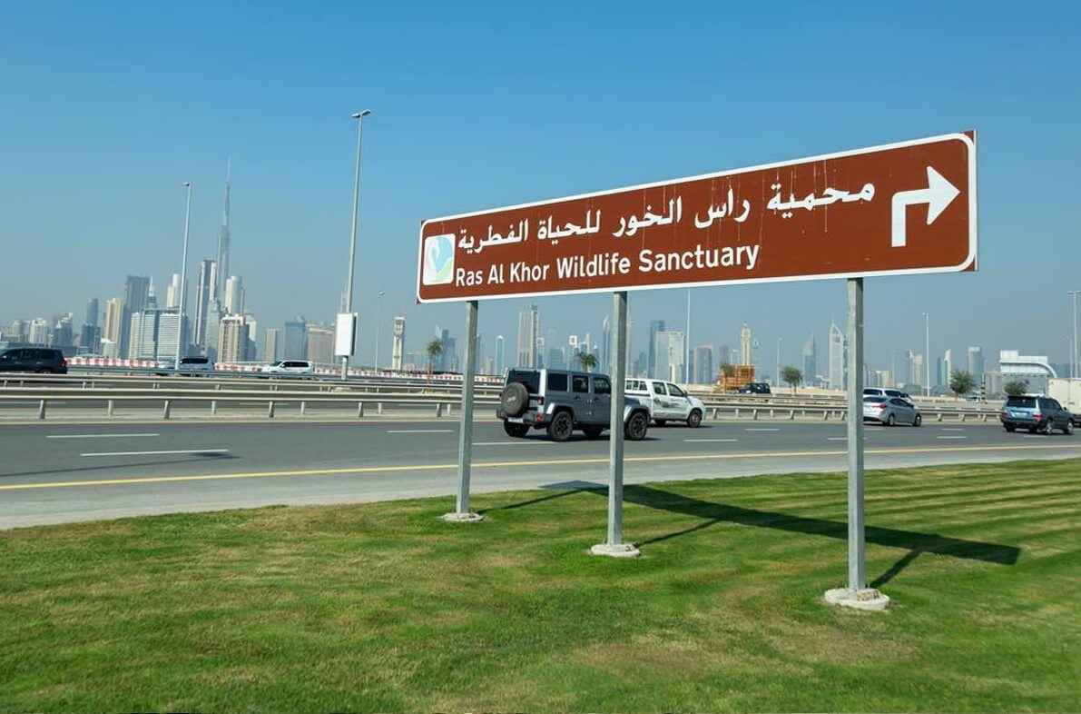
- Flamingo Hide — the most popular and most photographed, reachable via a signposted turn-off from Ras Al Khor Road heading back toward the city (westbound), roughly opposite the Ras Al Khor Industrial Area.
- Mangrove Hide — best at low tide, located toward the southern part of the reserve; walking between hides is generally not permitted, so plan each as a separate stop by car.
- Lagoon/Zabeel-facing hide — oriented toward the Zabeel fish ponds side, better for raptor spotting (Greater Spotted Eagles, Western Ospreys) than flamingos.
Entry is free and does not require a permit for individuals or small groups. Groups, media, academic institutions, or organised tours need to apply for a permit through Dubai Municipality (dm.gov.ae) at least three working days in advance.
Best time to visit
November through March is the peak season, when migratory numbers are highest and daytime temperatures are more comfortable for standing at an open-air hide. Early morning (around 9–10 AM) and late afternoon (around 3:30–4:30 PM) both align with feeding times and offer softer light for photography. Bring binoculars — the hides are set back from the water, and telescopes at some locations offer closer viewing but aren’t guaranteed to be available.
Ras Al Khor Industrial Area: The Working Side of the Road
On the opposite side of Ras Al Khor Road from the sanctuary sits one of Dubai’s most established industrial and trading districts. This isn’t a footnote — it’s a defining part of what makes the area function, and it’s the part almost every residential-focused area guide skips.
The Ras Al Khor Industrial Area is known city-wide for its auto market, a dense concentration of used-car dealerships, spare-parts retailers, tyre shops, and vehicle workshops that has made it a default destination for Dubai residents needing vehicle repairs, parts, or a used-car purchase. Beyond automotive trade, the zone houses warehouses, logistics operations, wholesale trading businesses, and a well-known fruit and vegetable market that supplies smaller retailers across the city.
This commercial density is also why Ras Al Khor Road carries meaningfully more truck and delivery traffic than a typical residential arterial road — worth factoring in if you’re comparing this area to a purely residential Dubai neighbourhood.
Living Near Ras Al Khor Road
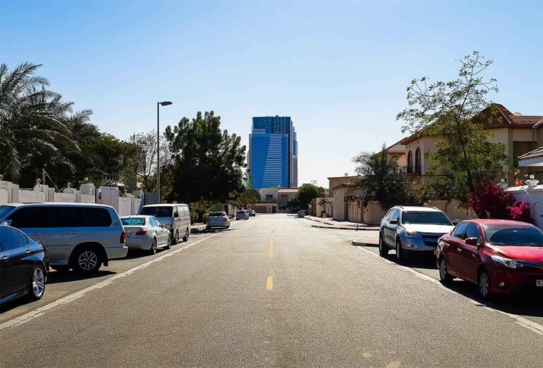
The residential pocket of Ras Al Khor sits south of the industrial zone and is genuinely distinct in character from both the sanctuary side and the trading side — quieter, low-rise, and largely apartment-based.
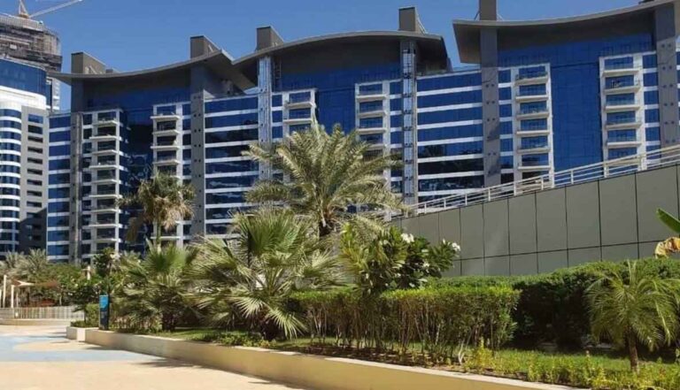
Housing stock. The area is dominated by one-to-three-bedroom apartments, with villas and townhouses less common. Buildings typically include covered parking, 24/7 security, and standard community amenities like play areas; premium units facing the sanctuary or the creek command higher rents for the view.
Affordability. Rental prices in Ras Al Khor generally sit below equivalent properties in central Dubai districts like Downtown or Business Bay, making it a common choice for professionals working in the industrial area, small families prioritising space-for-money, and investors targeting steady rental yield in a well-connected but non-premium location.
Schools and healthcare. There are no schools or hospitals directly inside the community. Families rely on nearby options including The City School International, Nadd Al Hamar School, and — across the creek — the Swiss International Scientific School and Lycée Français International de Dubai in Al Jaddaf. The nearest clinic is typically a 10-minute drive (Aster Medical Clinic), with fuller hospital services available in Dubai Healthcare City, roughly 20 minutes away.
Shopping and daily life. Marhaba Mall, on Ras Al Khor Road at the border with Nad Al Hamar, covers everyday needs with a hypermarket, a handful of restaurants, and a bank branch. For a full retail and leisure experience, Dubai Festival City Mall — home to Dubai’s only IKEA — is roughly 12 minutes away.
Public transport. There’s no metro station inside Ras Al Khor itself; Creek Metro Station (Green Line) is the nearest, roughly 10 minutes by car. RTA bus routes including 55, 61, 63E, 64, 64A, and X64 connect the area to Deira, Dubai Festival City, and other central districts, with stops concentrated near the industrial area and residential clusters like Samari Residences.
What’s Changing Around Ras Al Khor Road in 2026
The most significant nearby development is Dubai Creek Harbour, immediately across the creek, which continues to expand with residential towers, waterfront promenades, and retail. Its centrepiece project, the Dubai Creek Tower — designed to potentially surpass the Burj Khalifa in height — remains at foundation stage, with construction paused; visitors will currently see site groundwork rather than a rising structure.
On the infrastructure side, the E44/Al Khail Road corridor has been the subject of an ongoing RTA upgrade programme, including additional lanes, new flyover interchanges replacing roundabouts, and utility works, aimed at accommodating growth from Dubai Hills, Meydan, and the broader eastern corridor without pushing more traffic onto Sheikh Zayed Road. Drivers using Ras Al Khor Road regularly should expect intermittent construction-related lane changes as this work continues to roll out along the wider route.
What road is Ras Al Khor Road part of?
It’s a named segment of the E44 highway, sitting between Al Khail Road and Al Aweer Road, running from the D68 interchange to the E311 (Sheikh Mohammed Bin Zayed Road) interchange.
Is Ras Al Khor Road the same as Al Khail Road?
Not exactly. They’re both part of the same continuous E44 highway, but “Al Khail Road” refers specifically to the segment closer to Business Bay and JVC, while “Ras Al Khor Road” refers to the segment bordering the sanctuary and industrial area.
Are there tolls on Ras Al Khor Road?
No dedicated Salik gate currently sits directly on this segment, making it a toll-free route between eastern and central Dubai.
How do I reach the flamingo hide from Ras Al Khor Road?
Take the signposted turn-off heading westbound (back toward the city) roughly opposite the industrial area; the hide access is off a lay-by along the highway, not a standard street entrance.
Frequently Asked Questions
Is Ras Al Khor Road a good area to live in?
It suits people prioritising affordability, highway access, and proximity to work in the industrial or trading sector over central-Dubai prestige. It’s less suited to those wanting walkable retail, metro access, or a quiet, traffic-free environment, since major highways run directly alongside the community.
How far is Ras Al Khor Road from Downtown Dubai?
Roughly 10–15 minutes by car via Al Khail Road, depending on traffic and time of day.
Is entry to Ras Al Khor Wildlife Sanctuary really free?
Yes. Individual and small-group entry is free and doesn’t require a permit. Organised tours, media visits, and academic groups need a permit from Dubai Municipality, applied for at least three working days ahead.
What is the Ras Al Khor Industrial Area known for?
Primarily its auto market — used cars, spare parts, tyres, and repair workshops — alongside general warehousing, wholesale trading, and a fruit and vegetable market.
Can I walk between the different bird hides at the sanctuary?
Generally, no. Walking between hides such as the Mangrove Hide and Flamingo Hide is not permitted; each is reached separately by car or taxi.
Does the Dubai Metro reach Ras Al Khor Road directly?
No metro station sits directly on Ras Al Khor Road. The closest is Creek Metro Station on the Green Line, about a 10-minute drive away, with buses and taxis covering the last stretch.
What’s the best time of year to see flamingos at Ras Al Khor?
November through March, during peak migratory season, though flamingos are present and regularly fed year-round, so sightings aren’t limited to winter alone.
Is Ras Al Khor Road busy with traffic?
It carries a meaningful volume of commercial and truck traffic due to the adjacent industrial area, particularly on weekdays during business hours, though it remains less congested than Sheikh Zayed Road.
Why does Ras Al Khor Road have multiple names?
Because it’s part of the longer E44 highway, which Dubai’s route-numbering system labels differently by segment — Al Khail Road, Ras Al Khor Road, Al Aweer Road, and the Dubai–Hatta Highway — even though it’s a single continuous route.
Is there parking near the wildlife sanctuary hides?
Yes, free parking is available near the main hides, though it can be limited on weekends and during peak birdwatching season.
What is Dubai Creek Tower and is it near Ras Al Khor Road?
It’s a planned supertall structure across the creek in Dubai Creek Harbour, intended to potentially exceed the Burj Khalifa in height. Construction is currently paused at the foundation stage.
Are there schools inside Ras Al Khor?
No schools operate directly within the community; families use nearby options in Nad Al Hamar, Al Jaddaf, and neighbouring districts, generally within a 15–20 minute drive.

- Ismail Kouami: The Dubai Entrepreneur Building Companies Across Fintech, Mobility and Software - September 13, 2026
- 7 Costly Mistakes Entrepreneurs Make Before Hiring Company Setup Consultants in Dubai - September 5, 2026
- How Monthly Car Hire Simplifies Transportation During Home Relocations - July 27, 2026